Fully integrated urban water modelling
Manage the entire urban water cycle including water distribution and collection systems, native river and flooding through a single platform.
Why MIKE URBAN+?
Model all pipe networks within a city using one modelling platform
MIKE URBAN+ is the go-to software for all your urban water modelling needs. Get a complete overview of your urban infrastructure by modelling water distribution, collection systems, rivers and flooding with a single platform. Develop comprehensive master plans, plan maintenance work, optimise system performance and capacity, reduce leakages and so much more!
Play Video
Hear how MIKE URBAN+ can help water utilities tackle the most pressing water management challenges of today

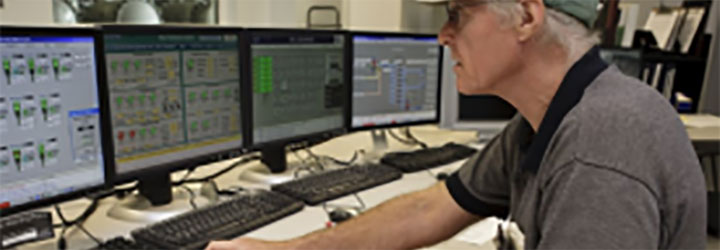
Hydraulic model of an all-pipe water distribution system; nodes color coded by service pressure, pressure time series
Plan, manage and optimise your water distribution network
With MIKE URBAN+, you can perform hydraulic and water quality modelling of your water distribution network to optimise performance, gain advanced control of pumps and valves as well as reduce non-revenue water and manage leakages. Plan network sectioning into DMA zones and hydrant flushing, perform fire flow analyses plus tracing of multiple sources, and monitor your network online – 24/7.
Model stormwater drainage and sewage collection in storm drainage and wastewater collection systems
Rely on MIKE URBAN+ to accurately simulate the functionality of separate or combined systems under a variety of operational and boundary conditions. For example, simulate network flows and water levels to improve the management of wet weather flows or design and optimise real-time controls to reduce sanitary sewer and combined sewer overflows (SSOs and CSOs), mitigate sulphide gas (H2S) formation and manage rainfall-dependent inflow and infiltration (RDI) in a smarter way. You can even assess the effects of potential green solutions to boost the resiliency of your city!

Analyse and optimise your storm drainage and wastewater collection systems with MIKE URBAN+

Model both collection systems and rivers through one intergrated geometric network with the new MIKE URBAN+ CS-River module
Perform integrated modelling of collection systems, river and 2D flooding
With the new CS-River module, you can now efficiently model collection systems and rivers through one integrated geometric network. Define cross sections, river branches and bed roughness, model culverts and weir structures and connect catchments and collection systems to model rainfall runoff. Couple a river to a collection system to analyse the interaction between collection system and river i.e. CSO spills. You can also couple both a collection system and river to 2D overland flow for flood assessment.
Build a more resilient city with 2D dynamic flood modelling
Perform dynamic flood analysis by seamlessly modelling flow exchange between the 2D surface and a 1D stormwater and river network. Use this information to prepare climate adaptation plans that include flood, damage, and risk maps, propose mitigation options for flood control measures, support emergency response planning and even build flood forecasting systems!
Play Video
Watch how you can create 2D flood models in MIKE URBAN+
Make MIKE URBAN+ your choice modelling platform
Water Utilities
Ensure compliance with regulatory requirements, better understand hydraulic network performance to streamline operations, reduce non-revenue water and manage leakages.

City Planners
Prepare climate adaptation plans as well as design resilient and sustainable urban solutions while protecting future investments in water infrastructures.

Flood Risk Management
Propose mitigation options for flood control measures and build real-time flood forecasting systems.

Developers
Understand which areas are safe to develop and which should be avoided – from a pluvial flood perspective. Determine solutions to reduce the impact of heavy rain and build-up of surface pollutants.
No in-house modellers?
Get our expert modellers on board for your consulting projects either as a partner, to provide extended user support or for model and project reviews. Submit an inquiry
See how MIKE URBAN+ helps customers tackle pressing water management challenges
Previous slide
Next slide
Previous slide
Next slide
Additional capabilities & unique features
Already a MIKE URBAN user? Benefit from the new generation of modelling software for urban applications by migrating your existing models into MIKE URBAN+. Enjoy enhanced capabilities, faster simulation speed and a more user-friendly interface. Download MIKE URBAN+ now.
The Model Manager is the core of the MIKE URBAN+ user interface offering a common data module for both Water Distribution and Collection Systems and a wealth of features including:
-
-
- Centralised network data management for storm water collection systems, wastewater collection systems, water distribution systems and 2D flooding
- Built-in GIS functionality powered by ThinkGeo
- Optional integration with Esri’s ArcGIS Pro
- Effective time series data management, comprehensive data processing and manipulation tools as well as powerful data visualisation capabilities for all data entities
- Built-in Result Viewer and MIKE VIEW, our standalone visualisation freeware tool, for an unlimited number of users
-
With MIKE URBAN+, you can import model data from various sources such as databases, shapefiles and Excel. Similarly, MIKE URBAN+ allows you to export model components to various file types using the Import and Export tool as well as the ArcGIS Integration option.
MIKE URBAN+ supports big data sets – up to 1,000,000 pipes so you can take on the most complex projects in large cities.
In addition to the variety of modules, MIKE URBAN+ also includes a number of tools to optimise your work including:
-
-
- Scenario Manager – Define, organise and report alternative scenarios
- Instant data validation – Correct missing or incorrect attributes that are automatically highlighted
- Interpolation and assignment tool – Derive (missing) model parameter values from other model or data layer information
- Catchment delineation tool – Delineate catchment polygons in an automated and reproducible way.
- Network simplification tool – Remove disconnected and unnecessary network elements outside an area of interest and eliminate internal nodes which appear as redundant and insignificant for the hydraulic computations.
- Calibration Editor – Define relations between externally measured data and simulation results, produce calibration plots and statistic data for calibration.
- Demand Allocation Editor – Specify geocoded wastewater load and demand allocation
- Model results presentation – View static and animated time series, profiles, maps, tables and statistics
-
Pinpoint specific challenges in your water distribution network with these WD-Basic modules:
Demand Allocation
-
-
- Manage junction node demands
- Geocode and aggregate consumption data
- Compute water demands for each node in your network
-
Water Quality
-
-
- Model blended water from different sources
- Analyse water age
- Locate chlorine residuals
- Understand the growth of disinfection by-products
- Visualise contaminant propagation
-
The WD-Tools module includes special features that allow you to:
-
-
- Run automatic calibrations
- Perform extended period simulations using embedded control options
- Simulate system shutdown, maintenance and intermittent water supply systems via pressure-dependent demands
- Perform advanced analyses with specialised pipe criticality, hydrant flushing, multi-source tracing, extended rule based control, variable speed driven pumps and PID control, sustainability and cost analysis tools
- Analyse improvements to meet fire flow requirements and calculate available flow and residual pressure
- Review detailed energy consumption results, create tabular outputs and graphs of pump/turbine utilisation, average power consumption/production and energy costs.
-
The CS-Pipeflow module supports simulation of standard and flexible cross-sections, circular manholes, retention basins, soakaways, overflow weirs, orifices, pumps, flow regulators and storm water inlets. Users can also simulate subcritical and supercritical flow conditions in partially full, full and pressurised pipes and even run continuous simulations of long periods.
MIKE URBAN+ offers multiple rainfall-runoff models such as time area method, kinematic wave and LIDS, linear reservoir and Unit Hydrograph Method (UHM). With the CS-Rainfall Runoff module, you can quickly prepare a precipitation-runoff model set to your desired level of detail in terms of spatial discretisation and input data. Simulate continuous slow response inflows such as infiltration using the Rainfall Dependent Infiltration (RDI) concept. You can also model the build-up and wash-off of pollutants with the re-designed Storm Water Quality concept.
By implementing LID principles and practices such as bioretention facilities, rain gardens, vegetated rooftops, rainwater tanks, and permeable pavements, stormwater can be managed in a more sustainable way. MIKE URBAN+ allows users to model various LID practices at both the hydrological screening and detailed hydraulic level to evaluate the effect of installing LID practices as part of a stormwater drainage system.
The MIKE URBAN+ CS-Control module enables advanced Real-Time Control (RTC) simulation capabilities for urban drainage and sewer systems. Describe various controllable devices (pumps, weirs, gates and valves) and define complex operational logic for interdependent regulators.
The specialised CS-Pollution Transport module allows users to model pollution transport by advection and dispersion as well as sediment transport including:
- Stormwater Runoff Quality (SWQ)
- Catchment Discharge Water Quality
- Advection-Dispersion (AD)
- MIKE ECO Lab (Water Quality)
If the sediment load, carried by wastewater and/or by stormwater runoff, in your urban drainage system is more than the self-cleansing capacity of the sewer can handle, significant operational problems may result such as reduced hydraulic capacity, increased overflows and full blockages of sewer pipes. With the CS-Pollution Transport module, you can analyse and eliminate existing or anticipated sediment related problems and help reduce operational costs by documenting design criteria compliance in terms of self-maintaining the sediment-free network.
To analyse complex water quality phenomena in sewer systems, different biological processes can be modelled by means of MIKE ECO Lab working in conjunction with the Advection-Dispersion capability of MIKE URBAN+ Water Quality. Users can describe the reaction processes of multi-compound systems including the degradation of organic matter, bacterial fate, oxygen exchange within the atmosphere and oxygen demand from eroded sewer sediments.
With the MIKE 1D Long Term Statistics (LTS) concept, you can set up a collection system network with intermittent hydrological inputs for a long-term simulation that covers a continuous historical period, possibly over several years. The system accurately computes wastewater treatment plant loads, CSOs and other system outputs by automatically combining dynamic pipe flow simulations during wet weather and simple hydrological simulation during dry weather periods. View results in the form of time series with a range of statistical parameters for selected variables. By running simulations with the current system configuration and the planned upgrade, users can test system performance based on planned investments (e.g. new sewers, retention tanks and RTC schemes).
The high-performance interface, database and hydraulic engines provide speed and accuracy even when modelling mega cities. Leverage the computational power of parallel processing on a multi-core CPU or multiple GPUs.
Model flooding in 2D through MIKE 21 FM and build the mesh directly within MIKE URBAN+ using the embedded Mesh Generator. Run the flood model by itself or coupled to a collection system and/or river branches. A 2D model can also be coupled to a MIKE HYDRO River model. Lastly, users can couple a MIKE 1D model to MIKE SHE for more advanced modelling of the interaction between a collection system or river and groundwater.
You can now access MIKE URBAN+ on Azure Marketplace, where you can start modelling in the cloud with no hardware limitation in four simple steps. Learn more
Explore related products
Let's get started
Learn how your project can benefit from this integrated urban water modelling platform.
Complete this form and we will be in touch soon.
Complete this form and we will be in touch soon.
(function (id, f, t, ws, ms_tr_il_08, ms_tr_il_w_01) { var tr = function (cb) { var count = 0; var callback = function () { if (count == 0) { count++; if (w) { w.w(id, t, cb); } } }; var ts = document.createElement('script'); ts.src = ws; ts.type = 'text/javascript'; ts.onload = callback; ts.onreadystatechange = function () { if (this.readyState == 'complete' || this.readyState == 'loaded') { callback(); } }; var head = document.getElementsByTagName('head')[0]; head.appendChild(ts); }; if (typeof ms_tr_il_08 === 'function') { if (ms_tr_il_w_01 === null) { tr(function() { ms_tr_il_08(id, f, t); }); } else { ms_tr_il_w_01.w(id, t, function(websiteVisitedParams) { ms_tr_il_08(id, f, t, websiteVisitedParams); }); } } else { tr(); }})('By-HH1p1HyEUIvLpK1a6VCOMG5sMXoAC-BmzSMR_m7c', 'https://7444fa84dfef4c4885ac3fa70f96dfe5.svc.dynamics.com/f', 'https://7444fa84dfef4c4885ac3fa70f96dfe5.svc.dynamics.com/t', 'https://7444fa84dfef4c4885ac3fa70f96dfe5.svc.dynamics.com/t/w', typeof ms_tr_il_08 === "undefined" ? null : ms_tr_il_08, typeof ms_tr_il_w_01 === "undefined" ? null : ms_tr_il_w_01);